White Population Mapping & Migration Trends
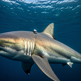
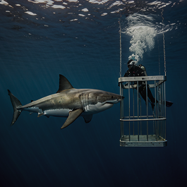
An institutional multi-year data collection initiative focused on tracking the seasonal displacement and reproductive behaviors of Carcharodon carcharias across the Southern Corridor.
Contextual Analysis
A Pillar of The Marine Monolith Archive
The Great White Population Mapping program represents a multi-decade commitment to understanding the planet's apex predators. By integrating high-resolution telemetry data with historical demographic records, we are building the most comprehensive longitudinal study of elasmobranch movement in scientific history.
Operating under the institutional ethics of the Oceanic Research Conservation Network, this project facilitates real-time data sharing across international maritime boundaries and regional protection zones.
Objectives
Scientific Objectives

Migration Pathways
Identifying high-traffic pelagic corridors to establish international maritime sanctuaries and reducing accidental commercial bycatch.

Genetic Diversity
Analyzing non-invasive tissue samples to determine sub-population health and evolutionary resilience in isolated oceanic pockets.

Climate Response
Predicting population shifts in response to ocean warming, acidification, and changing prey availability across the Southern Ocean.
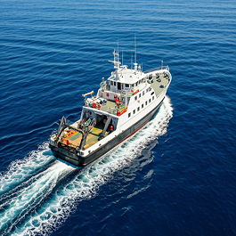
Field Methodology
Core Activities
Satellite Telemetry
Deployment of SPOT and PAT tags to monitor depth, temperature, and horizontal movement in real-time via the Argos network.
Biochemical Analysis
Stable isotope and hormone analysis to decipher dietary habits and reproductive cycles without physical capture.
Related Article
Read Another Article
 Research
Jul 18, 2023
Microplastic Concentrations in Coastal Elasmobranchs
A comprehensive study of stomach contents from local landing sites reveals an alarming increase in synthetic fiber ingestion among reef sharks.
View Article Field Activity
Jul 18, 2023
Voices from the Village: Co- Management Success
How local traditional knowledge is shaping the new management protocols for the Sawu Sea Marine National Park.
View Article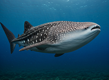 Conservation
Jul 18, 2023
Satellite Tagging the Giants of Cenderawasih Bay
Breaking down the first 6 months of data from our deep-water tagging program in West Papua's most famous bay.
View ArticleGallery
Field Documentation
Support Elasmobranch Conservation
Join an international network of institutions dedicated to preserving marine biodiversity. Your partnership fuels critical expeditions and data transparency.